Tuesday, May 31, 2016

Day 32 - Fair Grove, Missouri to Golden City, Missouri

Thursday, May 26,2016 67.7 miles(109.0 km)


It rained again overnight but had stopped by morning.  With a fairly long day I got going fairly early.  I stopped by the local convenience store for a coffee and the locals told me I would be facing some significant hills this morning.  Ther

It was not long into my ride a came across my first turtle for the day.  I picked him up and moved him to the side of the road.  I move them to the side of the road they are facing, if they are facing right they go to the right side of road and if facing left they go to the left side of the road.  Riding on a trike I don't really have to come to a full stop to move them as I am low enough to reach down and pick them up.  I only stop if I am taking a photo of them.  I moved nine turtles in short order and then did not see another turtle for several hours and then finally got number ten for the day.


Turtle #1


Turtle Ready To Wander Off


Turtle #5


Turtle #10 Wandering Off

The route was through the small towns of Walnut Grove, Ash Grove and Everton.  The small towns and countryside often have interesting and beautiful old church buildings.


Country Church


One institution which is quickly disappearing from small towns is the general store.  Below is an example of many that I have seen that have closed.


Abandoned General Store

I did come across this semi-friendly donkey.  He would come close to the fence but just not close enough to pet.  We did have a discussion and he didn't agree with something and shook his head letting me know.


Disagreeing Donkey


One of the most common birds I have seen on this trip are turkey vultures.  I often see them on the road in front of me, indicating roadkill ahead.  These three were sitting in a tree alongside the road.


Turkey Vultures

North of Ash Grove I passed the former home of Nathan Boone, Daniel Boone's son.  I did not stop by as I had visited it a few years ago.  To see photos from my early visit checkout here.


Nathan Boone Homestead Sign

I stopped in Ash Grove for lunch at the Copper Grill.  I had a good steak sandwich and fries along with about 5 glasses of water and 4 of root beer.  I guess I was thirsty.


Copper Grill

On this trip I have seen many odd things and signs in people's front yards but the sign I have pictured below is probably the most over-the-top.  I guess he and the game warden don't go have coffee together every morning.


Odd Sign

The last 5 miles into Golden City I was on a road with nice wide shoulders, was mostly flat and I had a nice tailwind.  They went very quickly.

I stopped at Cookie's Cafe in Golden City for dinner.  I had their chicken special followed by what they are known for, pie.  This small cafe probably had more than 20 different pies to choose from, my chose was strawberry rhubarb with a regular crust (as opposed to a Dutch topping) with ice cream.  All was excellent.


Strawberry Rhubarb Pie


I was camping that night at the Golden City Park.  I was again going to setup under the picnic shelter as rain was predicted again.  As I started setting up my tent a storm rolled in and the wind was very strong.  I had to tie the corners of my tent off to picnic tables as the wind was so strong I could not keep it in place without stakes.  That storm soon passed and all quieted down.


Day 31 - Hartville, Missouri to Fair Grove, Missouri

Wednesday, May 25,2016 42.9 miles(69.0 km)


The morning started with a storm about 4:30 am which woke me up as the rain beat down on the picnic pavilion I had my tent pitched under.  I quickly fell back asleep hoping the rain would stop before I wanted to get going.

I woke again about 7:00 and the rain had stopped.  I packed up and was on my way after a quick stop for some breakfast.  I was not in too much of a rush as I had planned a short day.  

Leaving Hartville was up a steep but fairly short hill and then I was back in a cattle farming area.  I stopped to take a rest and a group of calves was nearby.  Soon they moved to the corner of their pasture closest to me.  I had a discussion with a few of them, they seemed to listen intently.


Calf Listening Intently


Calf More Interested In Branch

The skies had been gray all morning but soon they darkened more and it began to rain.  Soon it was raining steadily and became a bit windy.  It was far from ideal riding conditions but I continued pedaling (not much choice as there was nowhere around to seek shelter).

It continued to rain as I arrived in Marshfield, Missouri and it was lunch time.  I stopped at Smokey's across from the court house and order a sandwich and some soup.  It felt good warming up and drying off as I ate my lunch.  After lunch I walk out and the sun was starting to shine through the clouds and by the time I had ridden to the north side of Marshfield the sky was blue with scattered clouds.  

The short afternoon ride was through rolling pastures and hay fields.


Hay Field - Blue Skies

As I was riding out of the Ozarks there were also new wildflowers to be found including different Black-Eyed Susans , Spiderworts and Pimroses.


Black-Eyed Susan


Spiderwort


Spiderwort

Pimrose

The ride for the day ended at the small community of Fair Grove which allows cyclists to camp in their city park.  They were having a farmers market in the park when I arrived.  Unfortunately the market did not have any berries or fruit as none were in season at the time.

After the market closed I set up my tent under the picnic pavilion as rain was likely again overnight.  

Friday, May 27, 2016

Day 30 - Summerville, Missouri to Hartville, Missouri

Tuesday, May 24,2016 60.9 miles(98.0 km)


I woke up early (5:30 am) and went down to the nearby convenience store to get some breakfast.  When I was there the clerk asked if I was heading out and advised I should wait a little as there was a strong storm coming.  I am glad I waited as it was a very strong thunderstorm which lasted about an hour but dropped a considerable amount of rain and was quite windy.

After the storm passed I started the ride.  I could see the storms off to the east of me and more out to the west.  I was riding through an area with mostly rolling hills on the Ozark highlands with mostly hay fields or pasture lands.

Ozark Highlands - Storm Off To East


Ranch Sign


The route also crossed the Big Piney River which was a nice break from the farmland.  There were several large turtles just hanging out in a slow part of the river.

Big Piney River


Big Turtles Hanging Out In River


Once leaving the river I was back up to more pasture and hay fields.  I had not visited this part of the state before and was surprised by the number of farms in the area, not what one pictures when thinking about the Ozarks.

Gloomy View As Storm Is Coming


Calf With A Mask


Cow Watching Me Watching It


I have seen many things displayed at the end of driveways mostly old agricultural equipment but this is the first time I have seen an old army style jeep.


Old Jeep

I also saw this very nice looking old one room schoolhouse.

Alice School


I had avoided rain all day and it was turning dark as the clouds moved in.  I was a couple miles from the next convenience store in Ben Davis, Missouri (not really a town) and I started pedaling as fast as I could and got there just in time as I got inside and the storm hit.  I waited that one out for about an hour and was able to finish the final 19 miles to Hartville.  I did get rained on while riding to Hartville but it was not a hard rain but hard enough that I put on my rain jacket.

In Hartville they allow camping on the courthouse lawn so I checked in with the sheriff's office on where it is allowed and they said anywhere but suggested I camp at the city park as it had a pavilion I could camp under.

My daughter M.E. drove down to Hartville and we had dinner together at a nice cafe.  We both had breakfast for dinner.  After dinner she drove me to the city park where I set up.  I am glad I decided to stay there as it rained quite hard over night.  

Day 29 - Ellington, Missouri to Summerville, Missouri

Monday, May 23,2016 47.5 miles(76.4 km)


After a nice night of sleep at the Ellington Route 76 Hostel I had planned to get on the road early as I knew the day was going to be a hilly one but I discovered I had a problem with the mounting of my bike bag that needed to be fixed.  The problem was solved with a 15¢ screw from the auto parts store and about 20 minutes to get it put together right.  

The days ride was a hilly one as expected with 4700 feet of climbing.  There were several hills along the way but two were quite large, one climbing out of the Current River valley and the other climbing out of the Jack Fork River valley.  

The ride was also very beautiful as it traveled through the Ozark National Scenic Riverways which is managed by the National Park Service.


Current River


Jack Fork River

Also along the way I visited Alley Spring and Mill, a very beautiful site to visit.

Alley Spring Mill
Alley Spring

The Ozark highlands allowed for some great view over the rivers and valleys below.


Ozark View

Near the end of the days ride I had climbed to what seemed to be the Ozark plateau where the terrain became more rolling and open farm land.

Navigation for the day was quite simple, get on Hwy 106 go west until it ends, your camping spot is across the road from where it ends.

I spent the night at the Summerville City Park, also staying in the park was a pack of Cub Scouts.  They were good kids and were having a good time.  Their leaders had them all quiet by 9:30 so all was good.

Sunday, May 22, 2016

Day 28 - Farmington, Missouri to Ellington, Missouri

Sunday, May 22,2016 61.5 miles(99.0 km)


The morning started with a early wake up and get things packed in the car for the ride back to Farmington.  Got to Farmington with no problem and quickly unloaded.  Patty and I said our goodbyes and I was off.  The ride out of Farmington was much nicer than the ride in, the weather was near prefect. 

The first town I came to was Pilot Knob, a site of a Civil War battle.  I stopped by the state historic site at Fort Davidson for a short walk around.

Fort Davidson Berm


Canon


Pilot Knob

The route then went north on State Highway 21, which was quite busy, fortunately it has nice wide shoulders to ride on.  Then the route followed State Highway N which was much less busy but did not have a shoulder either.  The route today was hilly but none of the hills were that steep and it made for good riding.  The route was through areas of farmland and also forested areas.

Missouri Countryside

My next stop was Johnson Shut-Ins State Park.  The park was the site of massive devastation in December 2005 when a power company dam gave way and 1.3 billion gallons of water washed through the park. Large boulders were brought down the hillsides and deposited in the park.   Fortunately no one was killed as a result of the massive flash flood.  The park has since been restored.

River At Johnson Shut-Ins


Boulder Moved 1.5 Miles During Dam Break


Boulder Field

After leaving the state park I crossed multiple forks of the Black River.  A very clear running river.

Black River

I stopped in Centerville for a late lunch at the 21 Diner.  They had a Sunday fried chicken special, chicken, mashed potatoes, gravy, green beans, Texas toast, it was excellent especially for the whopping $5.25 it cost :-).

From Centerville to Ellington is generally downhill however there were a few hills to climb but again none that were very steep.

I am starting see some different wildflowers from those that I previously had seen.

Yellow Wildflower


Blue Wildflowers

Tonight I am staying at a cyclists' hostel in Ellington.  It is pretty basic but it definitely will serve its purpose.  Hot shower, air conditioning and a dry place to sleep.

Overall a great first day back on the road.

Friday, May 20, 2016

Random Observations and Musings

After riding 1230 miles in 27 days (26 riding days and 1 rest day) with 81,300 feet of ascent across three states and into the fourth I have seen some interesting and varied things.  Below are some of the things I have observed or reflected upon.

Government policies and regulations can economically devastate areas that are already chronically economically disadvantaged.  This is quite evident in eastern Kentucky where coal has been the source of income for generations, current regulations have made things much worse in this area.  There are few if any alternatives as the infrastructure and education are not available for other sources of income.  Also many of the people in this region are very tied to the land thus will not or can not move to other areas.

Rural and small town America is severely under served in regards to the availability of nutritious food particularly fresh fruit, vegetables, and meat.  Many small towns and rural areas have no grocery stores and people must travel more than 30 miles each way to get to grocery stores.  This lack of stores impacts the poor most.  If a person is buying gas $2 to $3 at a time as I observed many times, they are not going to drive 60 miles round trip to buy groceries.  They are going to buy what is available in their area which is usually from a convenience store, which is usually food high in fat and/or sugar and/or salt and not very nutritious. Some believe that it is a lack of education that has people in these regions eating less than healthy food however if that food is not available it does not matter if they know it is healthy or not, they will eat what is available.  This problem will continue to get worse as more small town grocery stores close.

The more rubbish and junk in a yard and more dilapidated the house is the more likely there will be multiple no trespassing signs.  In eastern Kentucky nearly every home has at least one no trespassing sign, must be a required lawn ornament.

If one is involved in a long physically demanding  task it is important to listen to one's body.  If you start thinking about meat constantly, your body is saying you need protein.  If you start thinking of cakes and bread constantly then you need carbs.  Don't wait to have your body tell you need water just drink as you need it.  If your body gets tired earlier and earlier each day it is probably time to take a rest day.

Sometimes your body/mind lie.  As you are climbing a hill your body/mind might say you can't make it to the top  don't believe it... you can make it.  Suck it up the top is there somewhere.

Possums must be the stupidest animals in eastern United States as determined by an unscientific study of roadkill.  Dead possums out number all other road kill combined by 5 to 1.  The next closest is UAR's (unidentified animals remains) and often these are probably possums.  Then it is deer, squirrels and turtles all about equal.

 Loudon Wainwright III was correct in his 1972 classic song "Dead Skunk"  when he said "Dead skunk in the middle of the road, Stinking to high heaven"  They do stink to high heaven.   Those on the side of the road are pretty bad too.

Hills are one thing that the up side is much worse than the down side.

I will be back on the road on Sunday after a few days rest and getting trike tuned up some.

Day 27 - Chester, Illinois to Farmington, Missouri

Tuesday, May 17,2016 47.3 miles(76.1 km)


After a night that was less restful than most I have had on this trip (Frank did not like the combination of a taco salad followed by buffalo chicken wings and he let me know) I woke up to a steady rain.  I was quite happy that I had spent the night in the Eagles cyclists' bunkhouse.   I got loaded up and started to ride.  I asked a local woman if there was a cafe that served breakfast in Chester and she said yes, Joni's on State Street near the courthouse.  I was pleased with that as my route was on State Street and went right by the courthouse.   I ride down to Joni's and see the sign saying it is cafe and bakery... Great!! Just what I wanted.  Hmmm why is it so dark.  Open Wednesday through Monday, closed Tuesday.  Not again!!!   I have options I can either ride back up hill to where Hardee's and McDonald's are or I can continue and stop on the other side of the river at the convenience store located there.  I decide to go to the convenience store. (I don't ride up hills I don't need to)

Before leaving Chester I stopped by the visitors center to take a photo of the bronze Popeye statue and also take a photo of the bridge I was about to cross.


Popeye Statue


Chester Mississippi River Bridge


The bridge across the Mississippi River at Chester is a narrow two lane bridge without shoulders.  Once on the bridge it went well, traffic was very light and those vehicles I did encounter gave me plenty of space.

After crossing the bridge I stopped by the Missouri welcome sign... it feels good to be welcomed. :-)

Welcome To Missouri

Next stop was the convenience store for some breakfast.  They had some biscuit sandwiches which just did not appeal to me.  They also had hot dogs on a roller heater and along with hot dogs they had some different sausages and other things shaped like hot dogs so they could be heated on the roller.  I decided I would get one hot dog and something else.  Jalapeno sausages were out, Frank does not like those in the morning.  Buffalo chicken hot dog shaped things were out, Frank was not happy with buffalo chicken from the night before.  I opted for a sausage, egg, cheese hot dog shaped concoction.  Bad choice, it tasted what I imagine canned dog food would taste like (I do not have personal experience with the taste of canned dog food).  Its flavor was reminiscent of the canned eggs and ham found in the 1970s era C-ration, I didn't care for them either :-).   I guess I will stick with two hot dogs in the future.    

The ride on the Missouri side of the river started off nice and flat as it was in the floodplain.  There were several trucks along the route in this section however they were all very courteous and gave plenty of space.


Mississippi River Floodplain In Missouri


After about ten miles the route left the floodplain and became quite hilly.  None of the hills were very large but there were many of them. Once I got to St. Marys, Missouri I stopped at the convenience store there for a snack and coffee as it was the last stop available for the rest of the day.  While there Tyler caught up with me as he had left Chester after me.  We left the stop together and he took a few more photos of me and then cycled on.  He will get several days ahead of me however once in Colorado he is leaving the route for several days to attend a festival in Telluride and I will get ahead of him again.  He will probably catch back up with me somewhere in Montana.  

The rain continued to increase as the day progressed and was pretty much a downpour for the rest of the day.  It made for a quite uncomfortable ride but I continued on to Farmington, Missouri.


Hilly Rainy Missouri Countryside


Hilly Rainy Missouri Countryside


Once in Farmington I was to meet up with my wife Patty and then leave the route for a few days.  We met up in downtown Farmington.  We loaded my trike and trailer in the vehicle and I changed out of my wet clothes in the car.  I am sure I was wetter than I get when taking a shower, I was so wet and cold it felt good to get dry clothes on and have the heat going in the car.  

It is good to be taking a break.  It is only the second break so far on the trip and I haven't taken a day off since eastern Kentucky, it was time.

Day 26 - Crab Orchard National Wildlife Refuge, Makanda, Illinois to Chester, Illinois

Monday, May 16,2016 61.4 miles(98.8 km)


As I had a scheduled longer ride and weather forecast called for rain starting about 8:00 am I wanted to get an early start to the day. (I hate packing up a wet tent).  The route from the Refuge went on the south side of Carbondale, Illinois.  I stopped at the first convenience store I came to and had a second breakfast. (In hindsight it was fortunate I did as it was also the last one I saw).  

When I was on the south side of Carbondale I saw this fairly large herd of deer along the road.  They stood and watched me as I was watching them.

Deer Watching Me Watch Them


Deer Watching Me Watch Them

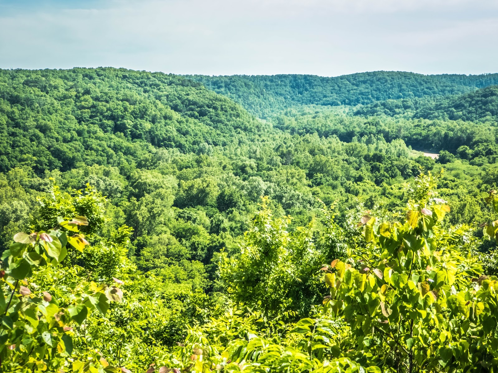
After leaving Carbondale I rode on to Murphysboro, Illinois where Map 10 ended, I have now completed 3 of 12 maps.  I am now on single digit maps.  Map 9 goes from Murphysboro, Illinois to Girard, Kansas.  On leaving Murphysboro there are two options on the route between Murphysboro and Chester.  One option is a hillier but always open route and the other is through the Mississippi River floodplain and is closed during flood conditions.  I opted for the floodplain route as it was open and flat. By this time it was raining fairly consistently.


Bluffs Above the Flood Plain


Once leaving Murphysboro the route descended to the Mississippi Rive floodplain and was completely flat except for the times it had short ascents to ride on road atop the levees.  There are a few small towns along this part of the floodplain, none have any stores not even convenience stores  and only one has a restaurant, Neunert.  Thus my plan was to ride to Neunert to eat lunch and ride on from there.  Neunert does have a restaurant, open Tuesday through Sunday, closed on Mondays, today was a Monday, next restaurant would be in Chester, my destination for the day.  I dig into my food supplies and eat a couple bananas and fruit and grain bars and ride on.

It was nice riding on the floodplain with no hills, just nice consistent pedaling. It would have been more enjoyable if it was not raining.


Flat Mississippi River Floodplain


Flat Mississippi River Floodplain


The route went up on a road on the levee for the Mississippi River and I was able get a view of the river a couple times.  I knew I would be crossing it the next day,


View of Mississippi River (Unsure what they are building)


Once leaving the levee road the route continues north on Illinois Route 3, a busy highway with many trucks bringing coal to a barge terminal.  As it was still raining and with the heavy traffic I want to make sure I was seen.  I had noticed that my rear flashing light had become a little loose and had turned so it was not facing directly back so I pulled over into a safe spot to tighten it and up rides Tyler, the National Geographic writer/photographer I had met the third day of my trip and had met up with a few times since.  He asked if everything was all right and if I was staying at the Eagles Club that night in Chester.  I informed him yes on both and told him I would catch up with him at the Eagles Club.

I then continued my ride into Chester, known as the Home of Popeye, as the creator of the cartoon Popeye grew up in the town.  I was quite hungry and I was wet but not soaking wet I decided to stop by Hardees for a taco salad before riding to the Eagles Club.  The Fraternal Order of the Eagles in Chester have a bunkhouse for cyclists which was great as it was now raining continuously,  


Chester Illinois Sign - Home of Popeye


After changing into dry clothes I joined Tyler and an eastbound rider from the United Kingdom at the Eagles Club.  As they ate dinner I had a few wings and a beer (my first since starting the trip)  I caught up with Tyler as I could not figure out how I had gotten in front of him again as he travels further than I do each day.  He had the cleats on his shoes set incorrectly and it put a bad strain on his knees and he had been laid up for a few days in a motel waiting for his knees to recover.  He then told me that his first article had been published on NationalGeographic.com and it featured me.  You can view his well written article here.


View From The Cockpit